Eric Martinen
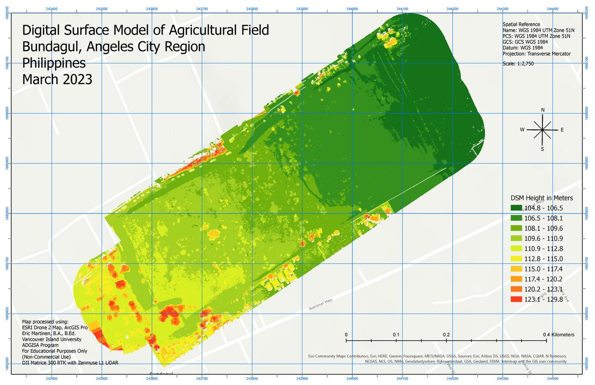
LiDAR sensor technologies have been useful as a relatively new method to generate elevation models of various terrain. These sensors use various platforms to ‘remotely sense’ objects within their range. One popular platform for LiDAR is the use of Drones. This submission to Carto Cup 2023 was developed after a private client requested elevation and surface models be generated from pre-existing Drone data.
As a Vancouver Island University ADGISA student, I became fascinated and intrigued about drones and their use within photogrammetry and remote sensing. In addition to learning how to process remotely sensed data and photogrammetry techniques, I sought to acquire my Basic RPAS drone license. Since acquiring my Basic RPAS license in February 2023, I am currently studying for my Advanced RPAS license.
While I have learned how to use various remote sensing and photogrammetry software such as PIX4D Capture, Cloud and Mapper, QGIS, ESRI Drone 2 Map and ArcGIS Pro, I chose to use ESRI software to process the LiDAR and imagery to produce this deliverable DSM product for Carto Cup 2023.