Andrew Wilson
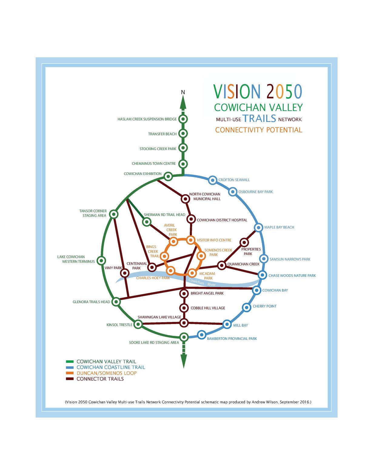
Andrew Wilson won the 2017 Carto Cup competition for his map showing his vision for the future network of multi-use trails in the Cowichan Valley.
In early 2015, the Municipality of North Cowichan (MNC) council voted to develop a Parks and Trails Master Plan. During the community consultation process later that year, an online discussion forum was utilized for feedback and suggestions. As an avid user of the multi-use trails in the region, this was a great opportunity to present ideas that would enhance the network. I felt that a visual representation would be helpful to convey the inadequacies and discontinuities of the existing multi-use trails, the disjointed links, and the lack of any loops or continuous connections. ... The purpose of the two maps is to: Show the connection deficiencies and lack of continuous loops in the existing multi-use trails network in the Cowichan Valley by visually contrasting the Connectivity 2016 map with the Vision 2050 map; [and to] propose a vision of how the multi-use trail network in the Cowichan Valley could look in 2050. - Andrew Wilson
Schematic maps of Cowichan Valley trails

