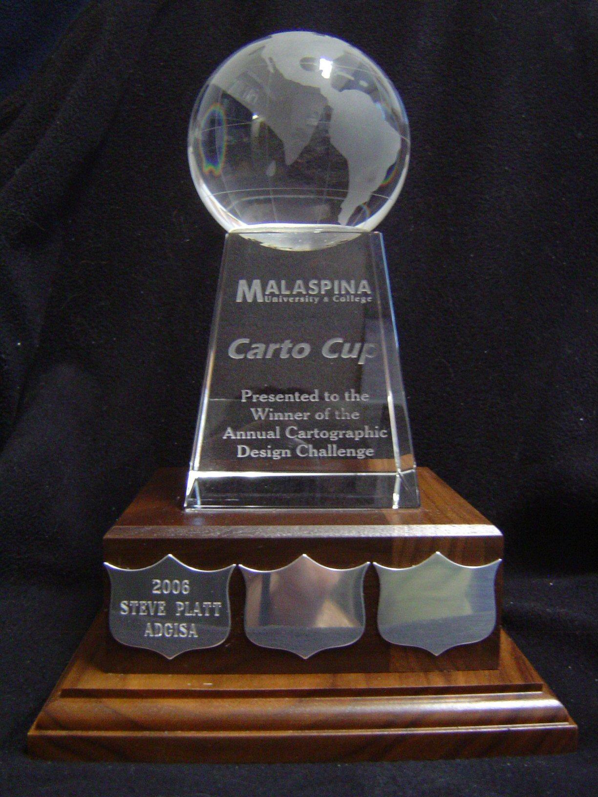
Vancouver Island University has a number of different programs in which Cartographic Design and Geographic Information Systems are taught. The instructors of these programs are all very proud of their students' abilities. In October, 2005 we decided to create a contest to encourage VIU students to produce cartographic products of which they can be proud. Thus was born the Carto Cup, which was first awarded in April, 2006.
The Carto Cup was initially conceived as being a globe-shaped cup trophy, similar in style to the Stanley Cup. However, when the design was finalized, we ended up with a globe-shaped crystal trophy, but the name stuck!
The Carto Cup is proudly displayed in the Map Library (Building 470 Room 242) on the Nanaimo Campus.
Students are encouraged to create a cartographically excellent representation of spatial data using the resources that are available to them. The submission may be on any topic and will be evaluated based on the following criteria:
1. Effective communication of the intended information
2. Cartographic quality
3. Innovative design
4. Overall attractiveness
The cutoff for submissions is 3:30 pm, on the last day of Spring semester classes (Friday, April 10, 2026), with submissions (map and written document) sent to:
Jessica Craig, Geography Technician
jessica.craig@viu.ca
1. This contest is open to all students of Vancouver Island University.
2. The judging committee must be informed of your intention to compete in the Carto Cup by the date shown in the Submission section of the Carto Cup website.
3. Submissions may be created using any media and may be static or dynamic in nature.
a. If entries warrant it, there will be two winners in a given year. A dynamic map winner and a static map winner.
4. Submissions may be created using manual or automated techniques
5. Submissions may be made on any permanent media
6. Students should submit:
a. A written description of the submission, including
- Background information on the topic
- How it was created
- What data were used
- What cartographic design considerations went into your submission
- Any interesting information about your submission (personal experiences relating to the submission, why this topic is of interest to you)
b. The submission is to be judged in a format that is accessible to the judging committee:
- An original document of any manually-created maps on paper or mylar
- A vector-based digital file (.wmf, .emf, .pdf) for GIS-created maps
- The URL of any web-based submission, or
- A permanent video or photographic record of non-traditional media.
7. The judges may, at their choosing, submit winning entries on behalf of the student to Esri, for inclusion in their yearly Map Book series.
8. A panel of judges will decide the winner. The decision of the judges is final. The Judging Committee is composed of experienced Geographers, who collectively have several decades of experience in Cartography and Geographic Information Systems.
9. All submissions become the property of Vancouver Island University and may be used (with due credit) for promotional purposes.
10. Contest rules may be altered from time to time to reflect technological changes in the mapping industry.

