Lindsay Richards
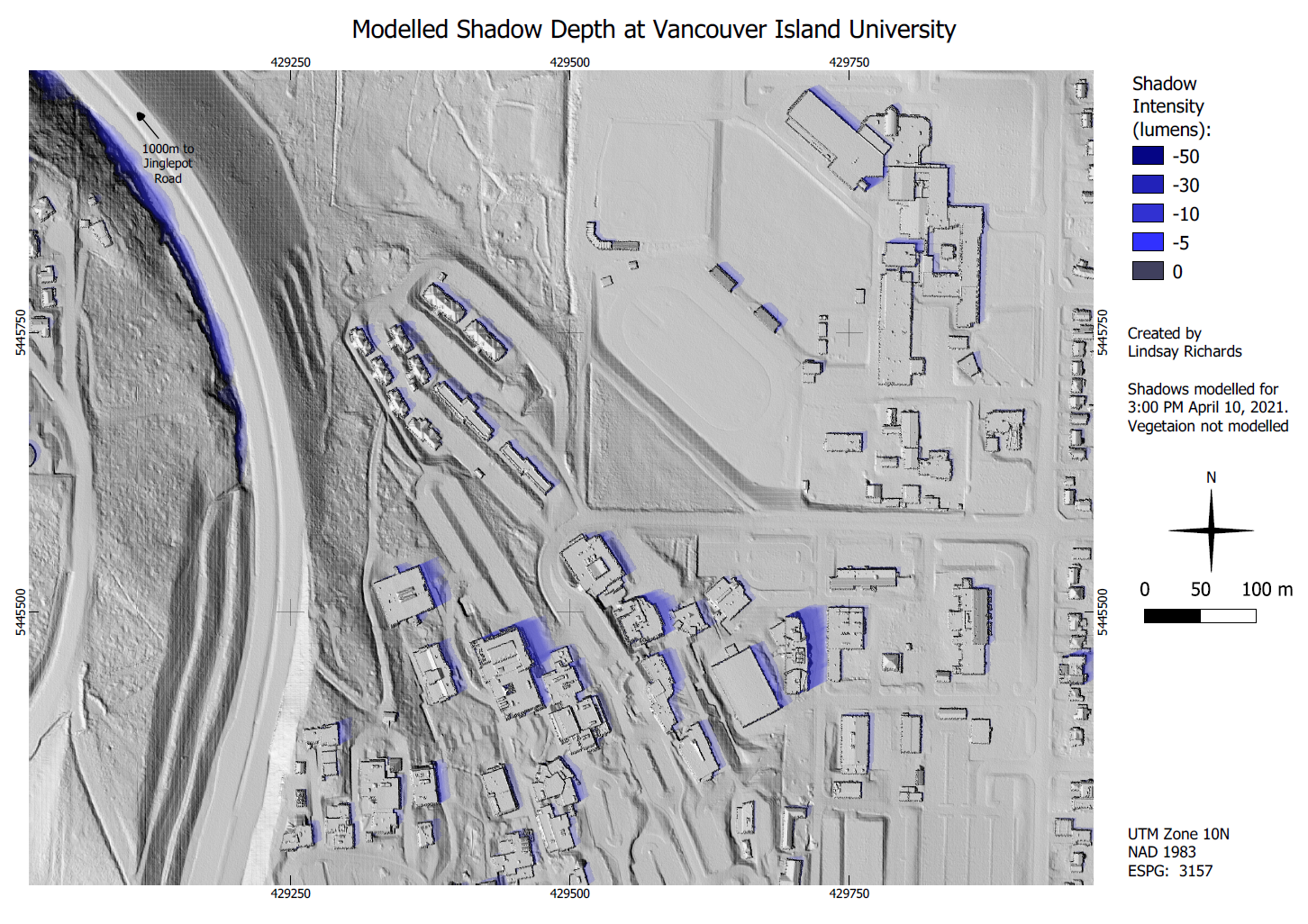
Lindsay, a major in Geoscience, entered the map 'Modelled Shadow Depth at Vancouver Island University'. This map was completed as part of his course work for Remote Sensing (GEOG 326), assessing various presentations of LiDAR data for designing solar-powered homes. Lindsay went a step further to create a model showing true location of shadows throughout the day, which could be used to predict where a solar installation might be shaded.
"I think the great thing about GIS is that it's dynamic, and just about anyone can take advantage of it. As our world becomes increasingly digital, it becomes more important for people to understand how technology shapes their world and the industries they work in. Open-source options like QGIS, which I used to create this map, help make this technology more accessible for anyone, to explore how GIS can be applied to their needs. I think that's really great because even if you never use it directly, it's important to be able to understand and communicate with the people who are doing the GIS work." - Lindsay
Congratulations Lindsay!